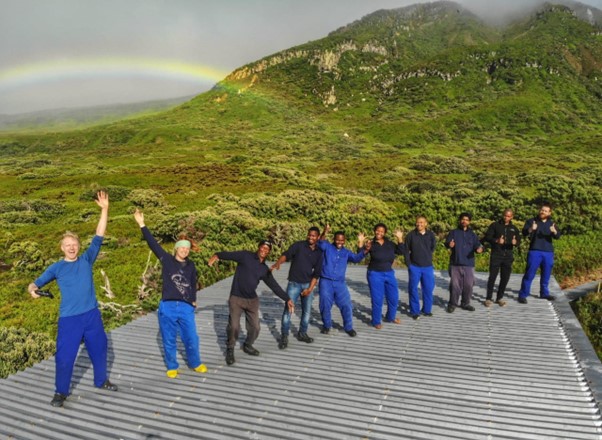
Featuring research teams currently on the Gough Island takeover expedition.
The Tristan da Cunha Conservation Department recruited two Tristan Islanders to assist in the field at Tristan for the duration of the takeover. Image of the two members of a previous team.
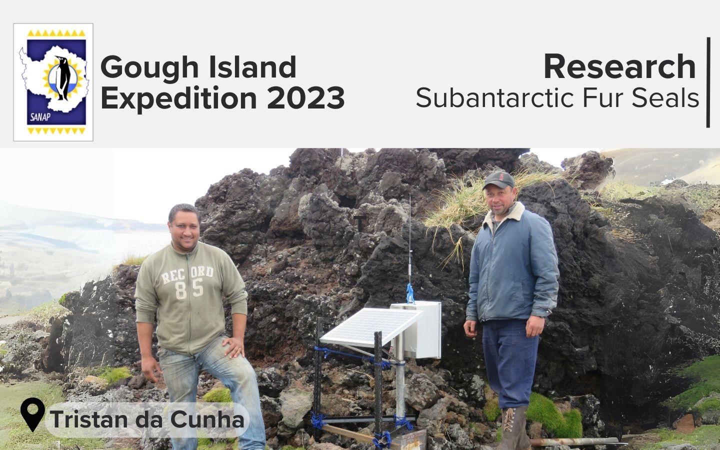
During the annual Gough Island takeover (relief) expedition, the S.A. Agulhas II delivers passengers and cargo to Tristan da Cunha Island, which is 350 kilometers from Gough Island. Additionally, several researchers are given the chance to carry out their research at Tristan da Cunha during the relief period for Gough Island.
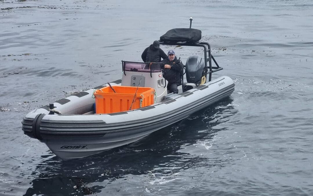
Prof Marthán Bester, semi-retired, Emeritus Professor and senior Research Fellow of the Mammal Research Institute at the University of Pretoria, is currently on the Tristan da Cunha to conduct field research on Subantarctic fur seals.
Find our more below about this project and prospects for the takeover period.
TEAM
Tristan Mammal Research
Project Name
Subantarctic Fur Seals at the Tristan da Cunha Islands, South Atlantic Ocean
Principal Investigator
Prof Marthán Bester
University of Pretoria
Co-Principal Investigator
Prof Nico de Bruyn
University of Pretoria
Co-Principal Investigator
Dr Mia Wege
University of Pretoria
Co-Principal Investigator
Mr. Trevor Glass
Tristan Conservation Department Head
The history of fur seal research on Tristan da Cunha
Fur seal research at the Tristan da Cunha (TdC) Islands started during the 1970s (1974–1978). In its present form, the research continues through a next phase (2009–2019), and beyond.
Short description of the project
Using Subantarctic fur seals as bioindicators of environmental conditions and as tools for suitable management of natural resources, contributing to observing marine ecosystems in the TdC Islands, since 2019 and beyond, the aim is to: (a) determine the seasonal attendance patterns of primarily lactating adult females, from the smallest (incipient) population of the species in the world at Cave Point Peninsula, TdC, (b) measure and contrast the growth rate and/or weaning mass of pups at the Cave Point breeding colony (10 month nursing period), (c) collect scat (non-invasive) and whiskers (invasive) samples for diet analyses.
During this ‘takeover’ the team aims to service and/or retrieve the Attendance Pattern Automated System (satellite-linked) at Cave Point, collect and process fur seal scat samples to determine diet, and weigh pup/under-yearling fur seals (at around 290 days of age) to compare their weaning weights amongst years and with those of pups from other island populations (including Gough Island).
In everyday language
The fur seals breed and rest on the islands, and they feed at sea. The research team aims to determine (1) what the seals feed on when they are away during feeding trips, (2) how well the pups, which remain on land, grow on a diet of milk which they suck from their mothers when these return to land after each feeding trip, and (3) how far away from the island, and for how long, do the mothers of the fur seal pups have to remain at sea on each feeding trip to be able to sustain their pups until weaning.
For more information visit about Subantarctic fur seals, click on the link below.
This project is funded by: The National Research Foundation (NRF-SANAP), The Royal Society for the Protection of Birds (RSPB) and Tristan da Cunha Conservation Department (TdC Conservation Department).
Update posted by the Tristan Conservation Department (on Facebook, 09 October 2023):
“The weather has been very nice last week. The conservation team and professor Martian Bester managed to go to the caves to do seal work with the seal pups. It was a great success as they managed to weigh fifty pups. Martian has been working with the conservation department for fourty nine years but sadly this is his last year working with the conservation team as he is retiring”
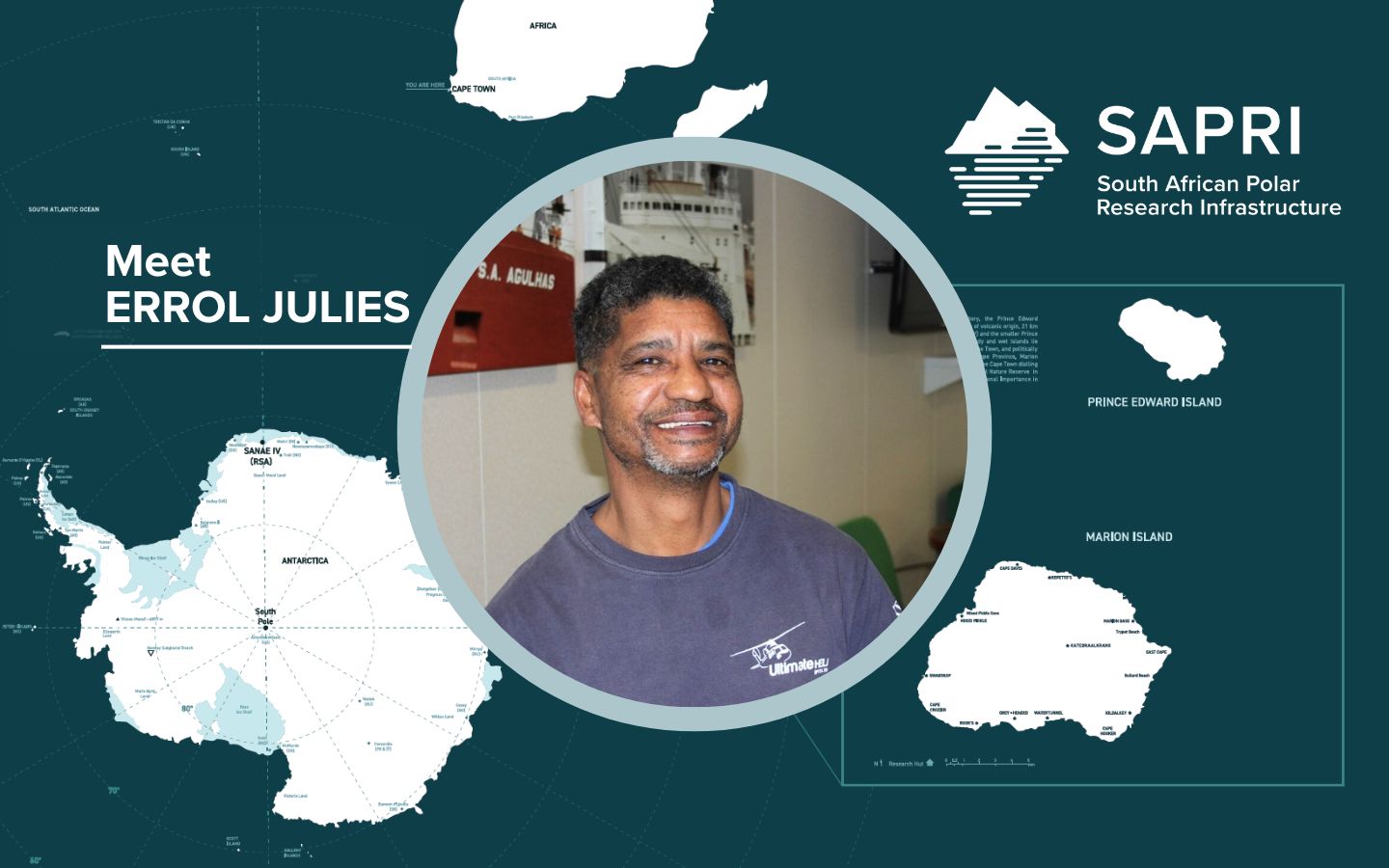
On the 1st of August, Errol Julies joined the South African Polar Research Infrastructure (SAPRI) as a Senior Electronics Technician, bringing with him a wealth of experience and a diverse skill set. His responsibilities at SAPRI encompass the maintenance of offshore marine infrastructure, asset management and supply chain management processes, providing technical support to researchers and students, ensuring compliance with the Occupational Health and Safety Act, and upgrading communication systems at the South African National Antarctic Programme (SANAP) research stations (bases), particularly the High Frequency (HF) systems at Marion Island between the base and field huts. Errol’s previous background and experiences make him an ideal fit for his role at SAPRI, where he continues to make significant contributions.
Meet Errol Julies: A Remarkable Journey of dedication and expertise
Errol Julies, hailing from the small town of De Doorns and having attended secondary school in Worcester, has embarked on an extraordinary path that has led him to become a highly accomplished professional in the scientific and research field.
Errol’s initial foray into the world of work began as an assistant train driver, but it was his introduction to the scientific realm at the Hermanus Magnetic Observatory (HMO), now known as the South African National Space Agency (SANSA), that truly ignited his passion. Starting as a general cleaner at HMO, Errol simultaneously pursued part-time studies and eventually obtained a BTech degree in Electrical Engineering.
For an impressive 17 years, Errol served as a Geomagnetic Observatory Technician at SANSA. In this role, he excelled in installing, maintaining, and monitoring geomagnetic and Magnetotelluric stations across Southern Africa. These stations adhered to the esteemed INTERMAGNET standards, a testament to Errol’s dedication in ensuring their construction and upkeep at the highest level. Additionally, Errol played a pivotal role in training aspiring geomagnetic observers from around the world during the biannual geomagnetic workshops hosted in different countries.
In 2015, Errol joined the Department of Forestry, Fisheries and the Environment (DFFE) as an Engineering Technician, specialising in telecommunications and instrumentation. His responsibilities encompassed managing the Very Small Aperture Terminal (VSAT) communications system from Cape Town to the SANAP bases, conducting calibration and testing of electronic equipment and instruments, and overseeing the maintenance and upgrade of electronic and HF equipment at all SANAP bases in accordance with specifications. Furthermore, Errol took on the role of Departmental Coordinating Officer (DCO), leading numerous voyages to the SANAP bases and successfully coordinating a voyage to Gough Island all by himself.
Driven by a thirst for knowledge and personal growth, Errol completed his BTech degree in Project Management in 2018, despite the challenges encountered during his voyage to Gough Island. In 2019 and 2020, he further demonstrated his resilience and expertise by overwintering on Gough Island as a Communication Engineer and team leader on the 65th Gough Island overwintering team. Currently, Errol is pursuing a Post Graduate Certificate in Education (PGCE), focusing on Mathematics and Mathematics Literacy for the Senior Phase and Technical Vocational Education and Training (TVET) colleges. This endeavor aims to support learners and students in his community through evening classes.
Errol Julies’ journey is a testament to his unwavering dedication, expertise, and commitment to excellence. His remarkable achievements and vast knowledge in the scientific and research field make him an invaluable asset to any organisation fortunate enough to have him on board.
Welcome to the SAPRI team, Errol!
Images supplied by Errol Julies.
Anche Louw, South African Polar Research Infrastructure, 13 September 2023
The South African Environmental Observation Network (SAEON) is a business unit of the National Research Foundation (NRF).
NRF SAEON celebrated its 21st anniversary on 7 September 2023. See the event programme below.
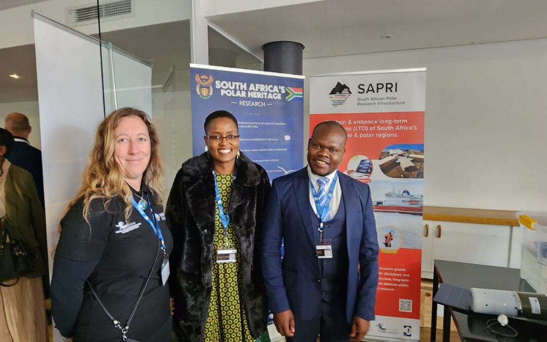
It is inspiring to see what SAEON has achieved over 21 years. “SAEON encompasses seven Research Nodes throughout South Africa and a National Office that is located in the country’s political capital of Pretoria” (Read more about the nodes here).
SAEON manages three research infrastructures developed by the Department of Science and Innovation (DSI) as part of the South African Research Infrastructure Roadmap (SARIR). The South African Polar Research Infrastructure (SAPRI) is one of the three research infrastructures, and was established in 2021 (see the SAPRI timeline here). The SAPRI hub is located in the SAEON Egagasini Node offices in Cape Town.
The SAEON Egagasini Node and SAPRI team at the NRF SAEON 21st Anniversary. Video: click on the image.
Message @dsigovza Dr. Gilbert Siko the crucial role of #NRFSAEON21st data marine & terrestrial for decision support contributing to national priorities & international commitments. Commitment to capacity building through opportunities from SAEON Platforms pic.twitter.com/810UYW9RUv
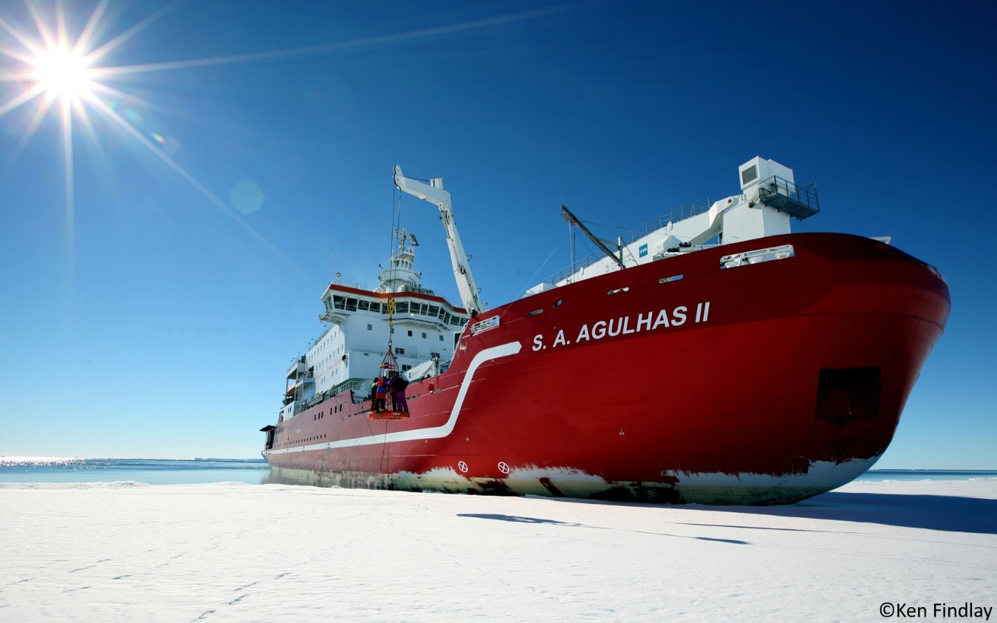
In 2015, The Department of Science and Technology (DST) facilitated the first dedicated oceanographic winter expedition on the S.A. Agulhas II from 23 July – 14 August 2015. The success of this expedition and others that followed demonstrated the need expressed by the wider marine and Southern Ocean research community and has prompted the DSI to secure funds for additional dedicated research expeditions in 2024, 2025 and 2026. The number of dedicated research expeditions will depend on the need expressed and the funding available. The core objective is to develop a comprehensive marine and Antarctic research expedition plan for 2024-2026, underpinned by the Marine and Antarctic Research Strategy (MARS) and contributing to the United Nations Decade of Ocean Sciences for sustainable development. These dedicated research expeditions will not only encompass oceanography but will provide research opportunities for marine-related and South African National Antarctic Programme (SANAP) –related research.
MARS was developed to provide a platform from which to coordinate marine and Antarctic research. The assumption is that improved coordination of a currently fragmented science system will improve returns on investment. Structured planning and a guided strategic focus will maximize human capital development and bring South Africa to the international forefront of knowledge production in these research areas. From this will follow innovation, increased international influence, and ultimately, economic growth.
The NRF and the South African Polar Research Infrastructure (SAPRI) have been tasked with coordinating various activities that will feed into improved planning and coordinating of marine and Antarctic research activities. As such, the NRF together with SAPRI would like to maximise on the opportunities for dedicated expeditions based on research community needs to enable long-term planning for expeditions, including sourcing funding for such expeditions. Dedicated expeditions may be implemented in periods where the S.A. Agulhas II is available. The schedule for the annual relief voyages indicate periods when the S.A. Agulhas II is not available (relief voyages for Antarctica, Marion Island and Gough Island). The direction (expedition transects), duration (including number and types of stations) and research focus of each dedicated research expedition would then be decided on by the DSI, together with the NRF, based on such variables as proposed participation, research area alignment, MARS theme alignment, contribution to the Ocean Decade and overall return on investment (data collection and capacity development.). To this end, SAPRI can support the costs of any in person meetings required to discuss collaborative research expeditions.
It should be noted that the attached annexure may change depending on the activities of the Department of Forestry, Fisheries, and the Environment (DFFE). For example, an emergency may require DFFE to deploy the S.A. Agulhas II to enable the Department of Public Works to do building maintenance and repairs at any of the three bases. As such, all potential dedicated expeditions will need to be approved by the DFFE before final planning can begin.
Please complete the template and return to tj.klarenbeek@risa.nrf.ac.za no later than 15 August 2023. The completed templates will give an indication of research community demand. More detailed research plans will be requested hereafter.
Text: Expression of interest, Participation in dedicated research expeditions 2024, 2025, 2026. Tracy Klarenbeek, Director: Knowledge Advancement and Support (KAS), National Research Foundation (NRF), Research Innovation Support and Advancement (RISA).
The South African Polar Research Infrastructure (SAPRI) is getting a corporate identity (CI).
The South African Polar Research Infrastructure (SAPRI) is one of 13 large Research Infrastructures (RIs) developed by the Department of Science and Innovation (DSI) as part of the South African Research Infrastructure Roadmap (SARIR).
The SAPRI was established in 2021 to ensure coordination of South African marine and Antarctic research as a national Big Science programme, providing seamless access to existing and new research infrastructure required to develop and enhance long-term observations of South Africa’s polar region.
The ultimate objective of SAPRI is to enable balanced research growth across the polar disciplines, and to maintain and further expand the world-class long-term observational datasets already established.
The SAPRI is designed as a consortium hosted at the South African Environmental Observation Network (SAEON), a long-term environmental observation and research facility of the National Research Foundation (NRF).
The SAPRI logo
The first step of the SAPRI CI was the design of a logo. The CI vendor has worked with a somewhat complicated brief, making sure that the CI is inclusive of marine and polar (land and sea), not focusing on one specific aspect within SAPRI.
The brief furthermore included:
Transforming, strengthening and consolidating SA’s marine and polar sciences.
Recognisable, professional and accessible.
Pride in SA’s involvement in marine and polar research.
SAPRI logo rationale:
The graphic element in this logo is a representation of SAPRI’s infrastructural support to research on both land and at sea.
While the top part is representative of land features of Antarctica and sub-Antarctic islands (e.g. ice, mountain), the bottom section represents water, or the ocean, as well as the shape of South Africa as seen on a map. In addition, the simplistic lines used to form the water is a rudimentary representation of data and the continuity of research.
To make for a versatile logo, transferable to different materials and backgrounds, various modifications can be used.
The main logo will have the colours of the South African flag incorporated.
Full colour versions (horizontal, vertical or in a circle):
Black versions (horizontal, vertical or in a circle):
White versions (horizontal, vertical or in a circle) – to be used on a full colour backgrounds: